The Cognitive Achievements of the Omanis
Evidence for the existence and deployment of multiple intelligences in a non-Western society
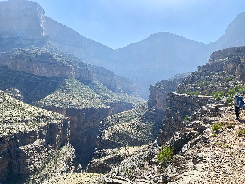
The Hajar mountains of Oman
© Alkiyumi, Mohammed
The Sultanate of Oman is in the eastern part of the Arabian Peninsula, characterized by a harsh climate where summer temperatures can reach 50 degrees Celsius. Morphologically, most of its area is desert, with a mountain range in the north known as the Eastern and Western Hajar Mountains. The northern mountains contribute to the formation of some orographic rainfall at certain times of the year. This rainwater flows down into valleys and streams, feeding some of the plains. Historically it has not much contact with Western scholarly traditions.
Despite the harshness of this environment, numerous oases were created through the construction of water canals called falaj. The main source of the falaj was digging a deep well and then digging a canal that connected this well to the surface. The construction of these canals and the management of their water are cognitive achievements that demonstrate a wide range of integrated intelligences: spatial, mathematical, kinesthetic, interpersonal, and linguistic. These accomplishments provide fresh and compelling evidence for the theory of multiple intelligences.
Managing this system to prevent potential conflicts over water shares requires meticulous and precise control. The Omanis devised a water allocation rotation system in which irrigation water was distributed among agricultural plots on a rotating basis every 5 to 12 days, depending on water level, soil type, and number of landowners. This system, known as Badaah, allocated irrigation for either a full day or half a day, with the first rotation for a particular plot occurring during the day and the second at night.
However, a problem remained: how much time each plot received during this rotation? While it depended on the plot's size, precise measurement was necessary. To address the issue, the Omanis developed the Athar (footprint) system. The length of a footprint was estimated by the time it takes for the sun's shadow to move from the heel to the tip of the footprint. In modern conversions, this interval is approximately 30 minutes. A subsequent challenge was ensuring accurate measurement of the Athar during both daytime and nighttime.
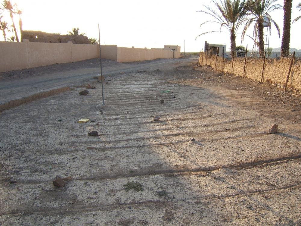
A sundial in Al Fath. Photograph: Harriet Nash, UNESCO
For daytime, the Omanis devised a distinctive sundial-based system for measuring the Athar. This system involves fixing a pole and drawing 24 lines: 12 in front of the pole and 12 behind it. When the sun rises on the pole, the shadow moves directly forward. After midday, the shadow falls behind the pole. The distances between the lines farther from the pole are greater than the distances between the lines near the pole because the sun moves faster in the morning and evening than at midday, however, all these distances are equal. When the sun moves from the beginning of the first line to the end, this is Athar. This system is still used in many falajs because it is more accurate than determining water allocations by the watch due to the differences in time between day and night and between summer and winter.
At night, however, the matter is more complex. Time must be calculated using something that is moving, and this is where the stars are used. The Athar must be calculated precisely by gazing at the positions of the stars. Here, the Omanis devised a stargazing system, determining the Athar by the interval between the rising of one star and the rising of another. This process requires a high level of perception, spatial judgment, and observational precision. If the Athar is divided in half, they must gaze at a star rising between stars 1 and 2; this is called the "mid-star." Adding to the complexity, each star is gazed at from a different location, requiring the stargazer to move from one place to another. Approximately 25 stars are gazed at, but the number of stars varies from one town to another. If there are clouds in the eastern part of the sky, which is the primary area for stargazing, the stargazer shifts to another 25 different stars in the western part.
These innovative achievements demonstrate the high level of cognitive abilities developed by the Omanis across multiple domains of intelligence. All of them depend significantly on the capacity to communicate clearly and effectively in language—for contacts, instructions, discussion (including argument) feedback, and passing on the tradition to younger generations.

Their spatial intelligence is reflected in their ability to interpret environmental features, understand the relationships among landforms, transform the movement of celestial bodies into precise measures of time, and accurately apply these observations to irrigation system.
Their logical intelligence is evident in the development of a sophisticated time– allocation system based on astronomical observations, the design of geometrically grounded measuring techniques, and the precise application of mathematical relationships to ensure equitable water distribution.
Their bodily-kinesthetic intelligence is demonstrated by physical endurance and technical skills required to excavate irrigation tunnels, construct canals, prepare agriculture lands, and sustain prolonged manual labor.
Their interpersonal intelligence is reflected in the establishment of an organized and sustainable administrative system capable of coordinating multiple stakeholders, preventing and resolving disputes, ensuring the equitable allocation of water resources, and promoting effective collective management.
Their linguistic intelligence is evident in the development of specialized terms and symbolic systems—such as Badaah, Athar, and the 24-line sundial—to communicate and preserve complex knowledge of water allocation, time measurement, and astronomical positions. in addition of using distinctive visual markings, such as the 24-line sundial, to represent and communicate precise time intervals.
Together, these achievements provide practical evidence of the interaction among spatial, logic, bodily-kinesthetic, linguistic, and interpersonal intelligences. This evidence also constitutes valuable empirical foundation for developing a theoretical framework—particularly for spatial intelligence—grounded in real-world human adaptation to complex environmental and engineering challenges, in addition to linguistic intelligence that involves using precise symbolic language and transforming it into clear expressive language and creating terms that were translated into practical application.
In an educational context, the cognitive achievements of the Omanis could be used to demonstrate how different strengths and abilities (also known as multiple intelligences) can be used to solve environmental problems. With these examples, teachers can show students how multiple intelligences contribute to reaching helpful solutions. The Omanis use skills from various approaches to knowledge, creation, and dissemination—mathematics, geography, physics, and language—to perform measurements, convert spatial movement into precise time, observe their environment, and develop precise terminology. Studying their achievements could also emphasize the importance of skills such as teamwork, administrative organization, and adapting to the environment.
The theory of multiple intelligences derives chiefly from research, conducted primarily in modern Western society. It is reassuring and confirming that even in a society with very different cultural traditions—including its own history, religion, and language—this work supports the basic claims and tenets of the theory.